
Trace a High Point Street
A useful address search is a chain, not a single list. Begin with the Guilford property search when the parcel is in Guilford, then save the exact owner display, mailing address, situs address, REID or PIN. Next, use map layers to establish the parcel’s city-limit, ZIP, ETJ, and county context. That order matters because High Point extends into Guilford, Forsyth, Randolph, and Davidson Counties. A street name or a High Point postal line does not choose the custodian for you.
- Enter the street number or street name in the county property listing and identify the likely parcel.
- Record the parcel’s REID or PIN, its situs, and its separate mailing address.
- Check the parcel against Guilford GIS and High Point jurisdictional layers for city, county, ZIP, ETJ, and road context.
- Use the owner and legal description to locate the purchase instrument through the Register of Deeds.
- For a dated household question, compare the address with HRC directory material, a voter record reached by name, or a Sanborn sheet.
This sequence keeps the evidence in its proper lane. A deed can document a transfer, a parcel record can identify a current owner, and a directory or voter record can provide a separate dated address clue. None of those alone creates a complete street roster.
High Point Parcel Search Fields
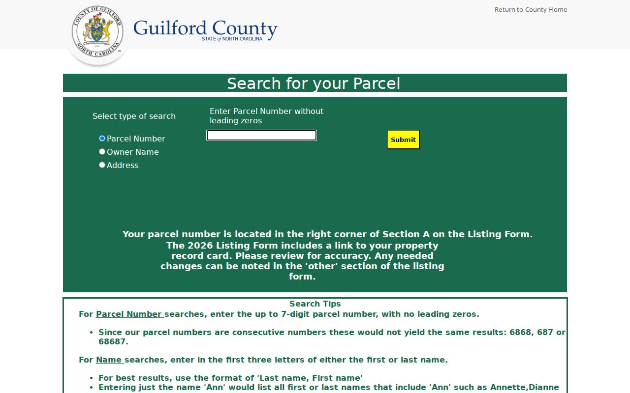
Guilford Real Property Listing has three visible search modes: Parcel Number, Owner Name, and Address. It is a current public property route, not a record of everyone at an address. Parcel numbers accept up to seven digits without leading zeros. Owner searches work best with at least three letters and the format Last name, First name. For an address, the portal accepts the first three street letters or the first three address digits, with a fuller entry such as a number plus street name giving a more useful starting point.
| Guilford field | Observed entry guidance | Street-search use |
|---|---|---|
| Parcel Number | Up to 7 digits, no leading zero | Return to a known parcel |
| Owner Name | At least 3 letters; last name, first name is preferred | Connect a named owner to a parcel |
| Address | First 3 street letters or first 3 address digits | Begin from a street location |
| NCPTS Street # and Street Name | Enter separately; omit street type and direction | Refine an address when the listing is broad |
| REID or PIN | Use the identifier returned by a parcel search | Carry the parcel into later checks |
The Guilford parcel search shows the three starting modes and its partial-search guidance.
Once a result is found, preserve the display exactly as shown and note the portal’s daily-change notice. County material describes parcel evidence that can include the owner, mailing and situs addresses, REID or PIN, GIS links, a photo where available, values, qualified sales, and appraisal-neighborhood material. It does not verify that every field appears on every parcel card.
High Point Street Map Layers
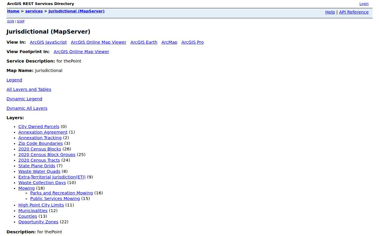
Map work is the jurisdiction checkpoint in this address search. Guilford’s Base Map and parcel services can show parcels, situs addresses, residential streets, roads, rail lines, streams, county boundaries, and city limits. The city’s thePoint jurisdictional service adds ZIP Code Boundaries, City Limits, ETJ, annexation material, census geography, roads, and city-owned parcels. Use the map to identify a parcel or street segment first, then return to the property portal for ownership and tax information.
The official High Point jurisdictional map service is the source for those ZIP, limit, and ETJ layers.
A map polygon is especially important when an address uses High Point as its postal place. The city has about 59 square miles inside city limits and a 3.2-square-mile ETJ in the January 2026 geography context, but neither figure makes a ZIP or street line into a county boundary. The official 2026 street map also marks city limits, ETJ, planning boundary, and county abbreviations, giving a second way to check the record route.
High Point Address Record Coverage
Each source below is keyed to a street in a different way. The property and GIS pair are the practical first stop for a current parcel. The later sources extend the question by date, legal description, service event, or historic structure. A result should be read as evidence from that specific record set, not as a conclusion about every person associated with an address.
| Address record | High Point route | What it can add | Access boundary |
|---|---|---|---|
| Parcel / property listing | Guilford Tax and Real Property Listing | Owner, mailing and situs, parcel ID, values, links or photos where present | Current online search; historical cutoff not published |
| GIS parcel and road layers | Guilford GIS and High Point thePoint | Parcel shape, situs, roads, city, county, ZIP, census, ETJ, annexation | Free map services; layer history not exposed |
| Land index and plats | Guilford Register of Deeds | Parties, instrument date and type, legal description, lot or subdivision references | County says land indexes and images are searchable 1771 forward |
| Permit / inspection | Build High Point and city records | Address-linked project, permit, or inspection chronology when public | Portal details vary; monthly reports are aggregate |
| Civil process | Guilford civil-process lookup | Address search, docket, service type, status, and disposition | Current live index; a service event is not an occupancy list |
| Directories and Sanborn | HRC, DigitalNC, LOC, NC LIVE | Printed address clues and building footprint or use | Directory and map dates must be kept separate |
Follow a High Point Deed Chain
An address is often a poor historic deed key. Start with the parcel’s current owner and exact legal description, then find the purchase deed by searching the owner as grantee. Read the grantor, recording date, book and page or instrument number, lot or block, subdivision, and legal description. The next step is to search that grantor as an earlier grantee, while comparing the legal geography each time. A split, merger, trust, estate, easement, or right-of-way can require following the parent tract or plat instead of a modern street number.
The Guilford deed-index target was identified for this address-to-instrument trail, but its live search form did not render consistently during the research inspection.
Do not claim unverified field names, an online-copy fee, or a universal result layout from that unstable interface. The county’s published claim is that land indexes and images are searchable 1771 forward. When a search does not resolve, the route is the Register of Deeds landing page, its High Point branch, or county assistance rather than a guess about coverage.
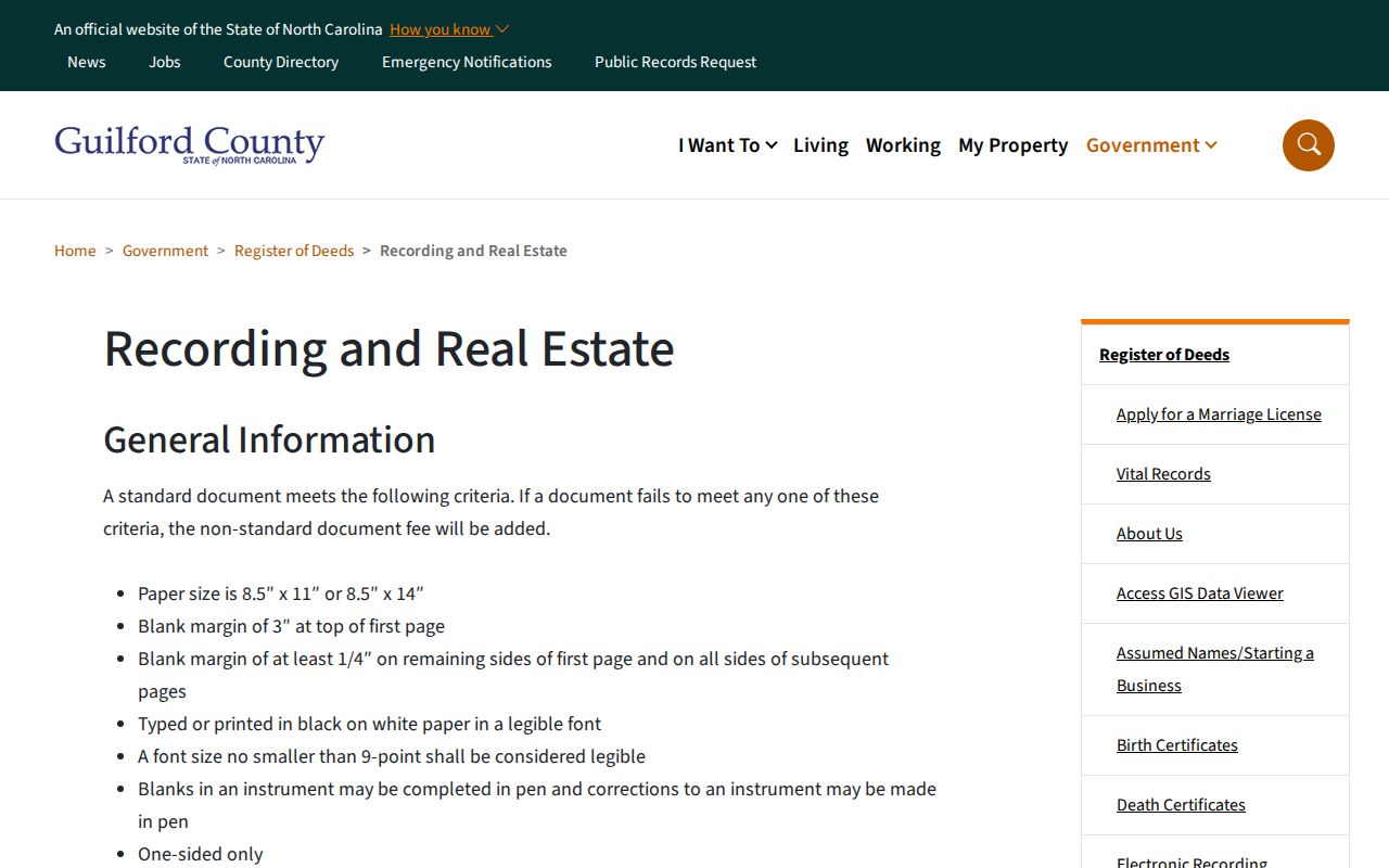
The Guilford Register of Deeds recording and real-estate page provides the county’s official route to the index and recording information.
The High Point Register of Deeds branch is at 325 E. Russell Ave., Room 155, High Point, with phone assistance at 336-641-7556. It is the county office for recorded land instruments, not the city clerk. Ask for the image or a certified copy when the index is only a pointer, because the legal description and party roles can clarify an ambiguous address.
High Point Voter Search Limits
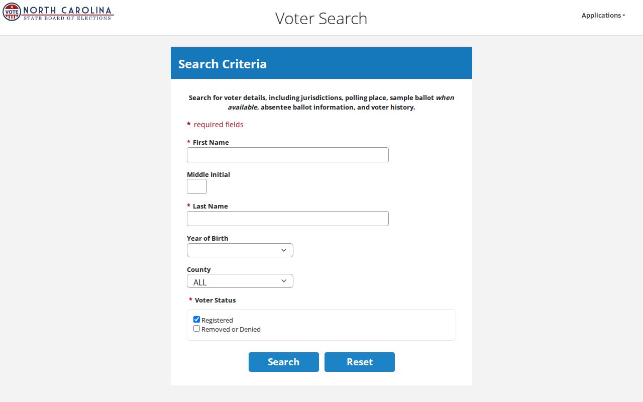
The public North Carolina voter lookup is name-first. It requires first name, last name, and a status selection, and can be narrowed with a middle initial, year of birth, or county. It does not provide a public browse-everyone-on-this-street feature. A result can show registration-related details, jurisdictions, polling information, and history when available, but it is not proof of ownership or a person’s presence on a given day.
The North Carolina voter lookup displays the required name fields, county option, and status controls used for an individual check.
For a lawful request for an address-based voter list, G.S. 163-82.10 permits county or precinct lists and regulates selective and electronic files. Requesters reimburse actual cost. A request should name the county or precinct, snapshot date, requested public fields, and format, then ask the appropriate board for cost. Since High Point crosses four counties, confirm the parcel county first. Protected and Address Confidentiality Program records must not be reconstructed through cross-referencing.
High Point Street Permit Dates
Build High Point and Accela Citizen Access are useful when the question concerns an address-linked project, permit, land-management record, board action, or inspection. The public portal is the address lead, while some account actions require login and the exact anonymous search fields were not exposed during research. High Point also posts monthly permit and inspection activity reports from July 2024 through July 2026. Those reports describe activity by permit type and trade, not a list of people at an address.
For one address, look for the public project or permit record first, then make a targeted city public-records request that names the address, date range, record type, and preferred electronic format. A permit can help date construction, alteration, or an inspection sequence. It cannot establish who occupied the building.
High Point Street History Sources
When a current portal cannot find an older number, use a deed’s legal description, a subdivision plat, a prior street name, a nearby cross street, and the printed street section of a city directory. HRC holds High Point city directories from 1910 to the present, while city history identifies 1908 as the first directory. A verified comprehensive reverse or criss-cross run was not located, so ask HRC specifically whether the needed volume has an address section rather than assuming it does.
Sanborn maps provide a different kind of evidence: building footprints, materials, use, and street layout, not a household list. The local history account places High Point Sanborn coverage from 1885 through 1956; North Carolina State’s digital map list identifies 11 maps through 1950, and the Library of Congress has a four-sheet 1896 scan. Label the collection and map date so the sources are not made to say the same thing.
- Parcel
- A mapped unit of land identified by the county. It connects a street location to a REID, PIN, and legal geography.
- Situs address
- The physical location of the land or building. It is distinct from the owner’s mailing address for tax correspondence.
- Plat
- A recorded map that can show lots, blocks, subdivision lines, easements, or other legal geography needed when numbers change.
- Criss-cross directory
- A printed directory arranged by address or street instead of personal name. Its presence must be confirmed for the specific HRC volume.
High Point Mailing Clues
Insider tip. Search the parcel owner’s mailing address separately from the situs. A different mailing line can point to the next record route, such as a post-office box, business, trust, or another residence, but it is not evidence that the owner lives at the parcel.
This distinction is one reason a street-by-street search should preserve exact fields rather than combine them into one address. It also helps avoid a common mistake: assuming an owner record answers who is currently at a property. For historical work, keep the record date beside each mailing or situs display and compare it with the correct dated directory, deed, or map.
High Point Street Search Boundaries
There is no one-click public owner list for an entire street in the inspected property tools. Build a block from parcel-by-parcel map identification, then open each relevant parcel in the tax portal. Civil-process results describe a service event and status, not a household roll. Postal ZIP lines, city limits, county lines, and voter precincts also remain separate systems. Treat a missing record as an access or date question, not a reason to fill the gap with an assumption.
Personal and lawful use. Use High Point address records for legitimate personal, civic, family-history, estate, or property research. North Carolina law protects some voter and address information, and G.S. 14-277.3A addresses stalking. Do not use an address clue for repeated unwanted contact, harassment, threats, or an attempt to defeat a protected address.